
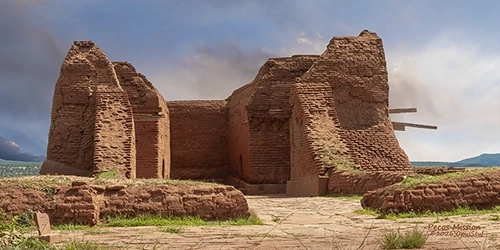
Pecos Mission Wall Art Print
Pecos area east of Santa Fe, New Mexico was settled centuries before Spanish explorers arrived. The Pecos Pueblo is estimated to have been built around 1100 AD by the local inhabitants. The pueblo became a regional trade center among the various tribes around 1450 AD.
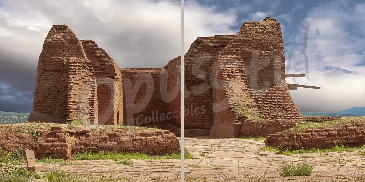
Pecos Mission Diptych (2-panel) Wall Art Print
Pecos area east of Santa Fe, New Mexico was settled centuries before Spanish explorers arrived. The Pecos Pueblo is estimated to have been built around 1100 AD by the local inhabitants. The pueblo became a regional trade center among the various tribes around 1450 AD.
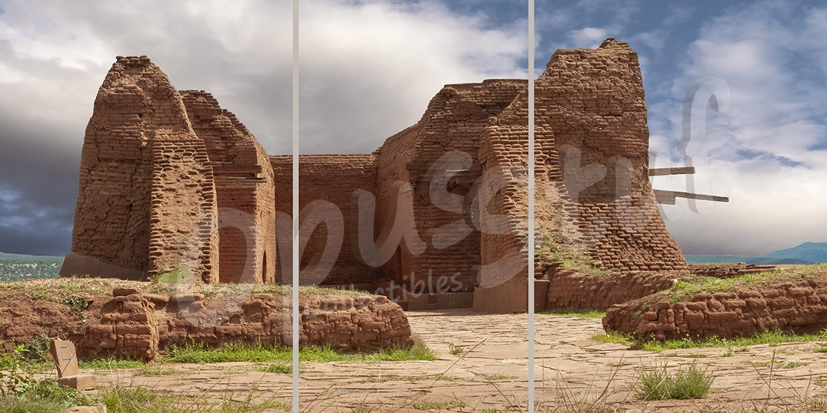
Pecos Mission Triptych (3-panel) Wall Art Print
Pecos area east of Santa Fe, New Mexico was settled centuries before Spanish explorers arrived. The Pecos Pueblo is estimated to have been built around 1100 AD by the local inhabitants. The pueblo became a regional trade center among the various tribes around 1450 AD.

Sandia Moon 3:1 Pano Wall Art Print
Sandia is Spanish for watermelon. The Sandia mountains in Albuquerque, NM at sunset often resemble a slice of watermelon, which is where the name originated with early Spanish conquistadors. This 7-section stitched panorama includes the autumn harvest moon as it is just rising.
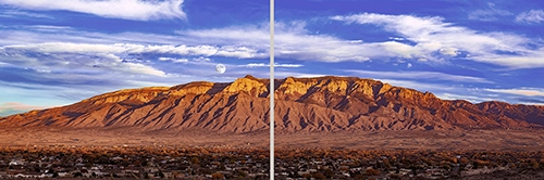
Sandia Moon Diptych (2-panel) Wall Art Print
Sandia is Spanish for watermelon. The Sandia mountains in Albuquerque, NM at sunset often resemble a slice of watermelon, which is where the name originated with early Spanish conquistadors. This 7-section stitched panorama includes the autumn harvest moon as it is just rising.
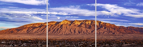
Sandia Moon Triptych (3-panel) Wall Art Print
Sandia is Spanish for watermelon. The Sandia mountains in Albuquerque, NM at sunset often resemble a slice of watermelon, which is where the name originated with early Spanish conquistadors. This 7-section stitched panorama includes the autumn harvest moon as it is just rising.
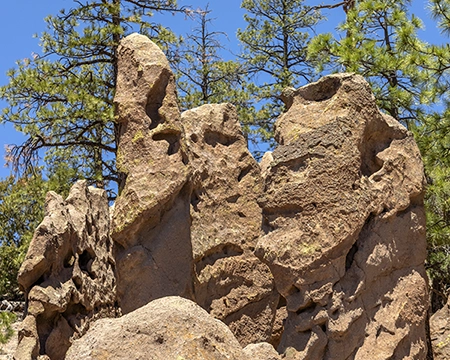
Goblin Colony 1 Wall Art Print
Goblin Colony 1 is a wall art print of rock formations near Ponderosa, New Mexico. The unusual shapes of these formations were created by erosion of volcanic tuff deposited over a million years ago. The shapes and shadows in the rocks often resemble faces, heads and bodies of strange creatures.
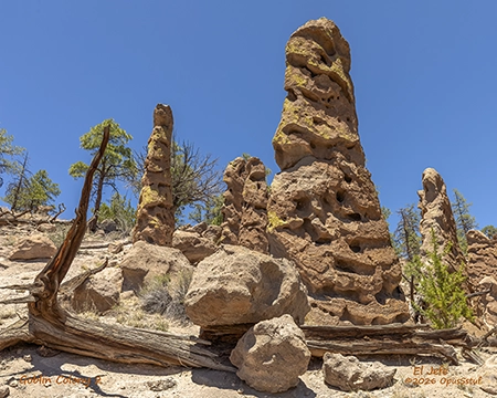
Goblin Colony 2 El Jefe Wall Art Print
Goblin Colony 2 El Jefe is a wall art print of rock formations near Ponderosa, New Mexico. The unusual shapes of these formations were created by erosion of volcanic tuff deposited over a million years ago. The shapes and shadows in the rocks often resemble faces, heads and bodies of strange creatures.
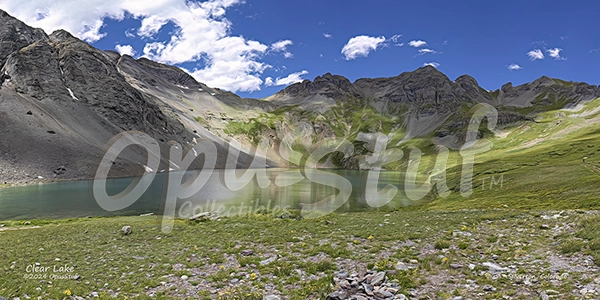
Clear Lake Wall Art Print
Clear Lake is a 2:1 panoramic image of a high country lake in southwestern Colorado. The road climbing to the lake is rocky with tight switchbacks. After the climb up the mountainside, you cross over the last rise to a view of the lake that is simply stunning.
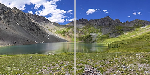
Clear Lake Diptych (2-panel) Wall Art Print
Clear Lake occupies a naturally formed bowl at 12,000 ft. above sea level in the mountains seven or eight miles southwest of Silverton, Colorado. The road climbing to the lake is rocky with tight switchbacks and 4 wheel drive is strongly suggested.
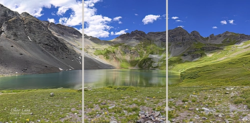
Clear Lake Triptych (3-panel) Wall Art Print
Clear Lake occupies a naturally formed bowl at 12,000 ft. above sea level in the mountains seven or eight miles southwest of Silverton, Colorado. The road climbing to the lake is rocky with tight switchbacks and 4 wheel drive is strongly suggested.
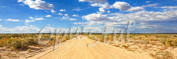
Rainbow Blvd 3:1 Pano Wall Art Print
Rainbow Blvd is a lonely dirt road in central New Mexico named as a “boulevard.” The city planners must have big plans for the future. For now, typical traffic on the road is lizards and roadrunners. This image is perhaps the definition of wide open spaces, and a prime example of the high plains across a large part of New Mexico.
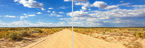
Rainbow Blvd Diptych (2-panel) Wall Art Print
Rainbow Blvd is a lonely dirt road in central New Mexico named as a “boulevard.” The city planners must have big plans for the future. For now, typical traffic on the road is lizards and roadrunners. This image is perhaps the definition of wide open spaces, and a prime example of the high plains across a large part of New Mexico.
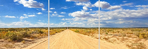
Rainbow Blvd Triptych (3-panel) Wall Art Print
Rainbow Blvd is a lonely dirt road in central New Mexico named as a “boulevard.” The city planners must have big plans for the future. For now, typical traffic on the road is lizards and roadrunners. This image is perhaps the definition of wide open spaces, and a prime example of the high plains across a large part of New Mexico.
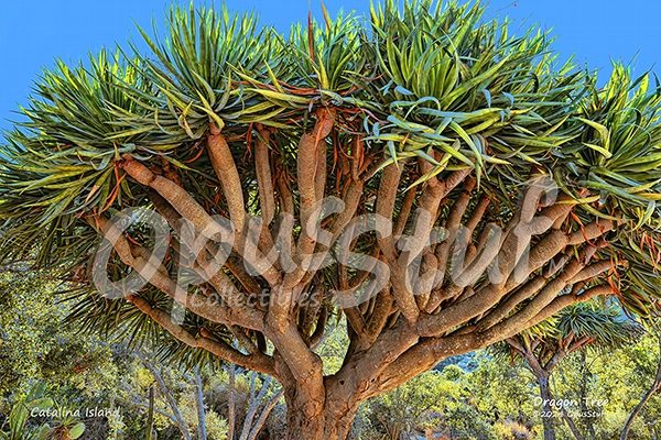
Dragon Tree Wall Art Print
This particular tree is a feature in the Botanic Garden on Catalina Island off the coast of California. It resides next to the pathway that leads to the Wrigley Memorial, and stood about 15 feet tall when this photograph was made in October 2017. An “enhancement” was applied to make the image “pop."
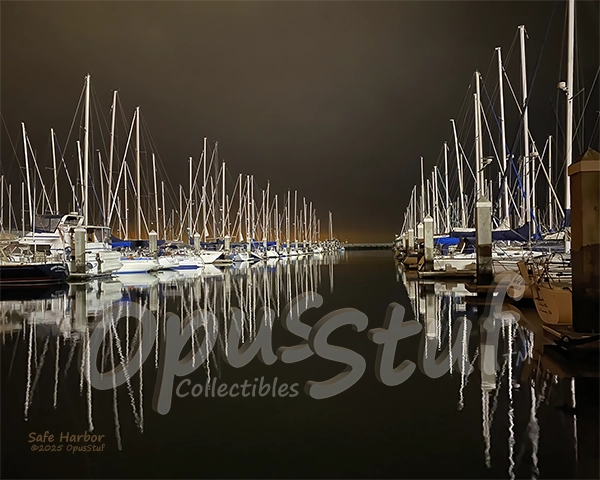
Safe Harbor Wall Art Print
Safe Harbor was taken around the time of the “Orange Skies Day” in San Francisco, CA in September 2020. The smoke from large fires east of San Francisco mixed with fog to deliver the orange hue in the sky. This unique and dramatic photograph was taken by a boat owner in the South Beach Marina.
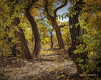
Merlin's gateway Wall Art Print
It's a magical little cove in a less traveled part of the Rio Grande Bosque. The cottonwood trees stand tall in a wild assortment of shapes and angles, and the forest floor is blanketed by fallen brush and leaves. It's a warm November day with a celebration of fall colors.
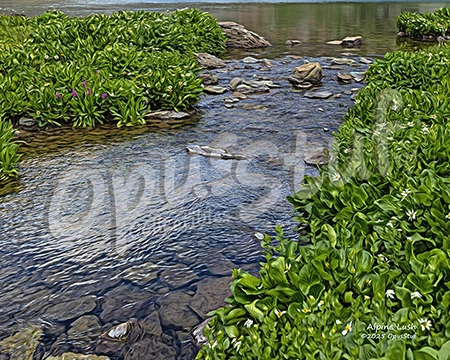
Alpine Lush Wall Art Print
Lush vegetation and crystal clear water at the output of Clear Lake in southern Colorado. At 12,000 feet above sea level it's a miracle of God's design. Chilly silence and the faint trickle of the slow moving water is an incredibly calming experience.
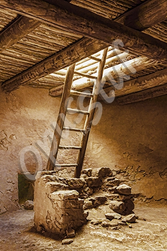
Pecos Kiva Wall Art Print
Pecos National Historical Park in New Mexico is a preservation of a site that was a center of cultural and economic activity from about 1325 C.E. The location was on the Santa Fe Trail and functioned as a destination and stop over point for traders and travelers from hundreds of miles away. It was populated until about 1830 when the last of the inhabitants migrated to the Jemez Pueblo.
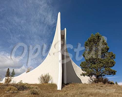
Vietnam Memorial Wall Art Print
The Vietnam Veterans Memorial was built in honor of 17 soldiers who lost their lives in a battle near Con Thien, South Vietnam. The chapel is an elegant structure rising above the terrain on a south facing slope overlooking the town of Angel Fire in the Moreno Valley.
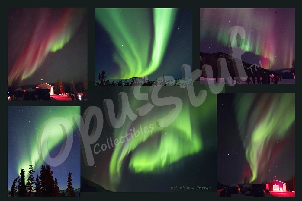
Astonishing energy Wall Art Print
A collage of photographs taken in Alaska in March 2025 on clear nights. Green ribbons of light are typical and red ribbons are less common. These images show only one example of the types of energy in our universe.
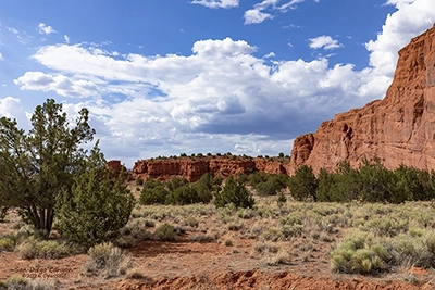
San Diego Canyon Wall Art Print
San Diego Canyon in New Mexico extends from Jemez Pueblo north through Jemez Springs to La Cueva. The scenic drive along New Mexico state road 4 runs the length of the canyon, with towering red sandstone walls in the southernmost section. This photograph was made in July 2018 on a bright, sunny day with beautiful skies.
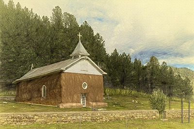
Macho Chapel Wall Art Print
Macho Chapel is located a few miles north of Pecos, New Mexico. The original church was a small structure built in the 1830's. The building was updated to the current structure in 1858 by Spanish-American colonists. This image is best printed on canvas or coldpress fine art paper.
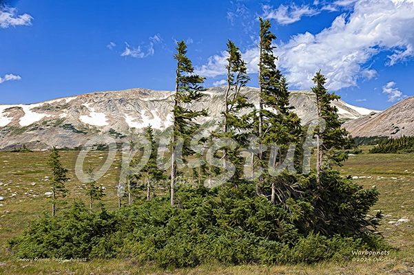
Warbonnets Wall Art Print
At the summit of Snowy Range Pass, at over 10,000 feet above sea level, the wind is so strong and persistent that the upper evergreen branches grow on the downwind side of the trees, resembling a Native American warbonnet headdress.
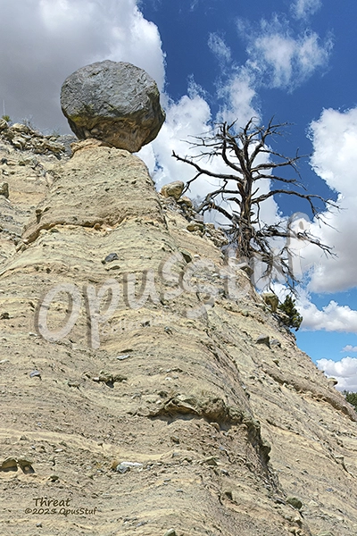
Tent Rocks Threat Wall Art Print
"Whoa, better keep an eye on this one." Walking the path below this balancing marvel creates a bit of an uneasy feeling. Looking up 80 or 90 feet to this natural marvel, it appears that there is little or nothing keeping the boulder from rolling down the slope. This is one of many "hoodoos" in the Kasha-Katuwe Tent Rocks National Monument.
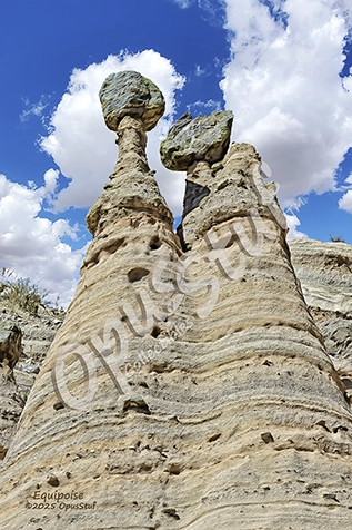
Tent Rocks Equipoise Wall Art Print
It could be they are cousins, certainly not twins. They do have a common root below them. This mighty balancing act stands around 80 feet tall. This pair is accompanied by many other "hoodoos"* in the Kasha-Katuwe Tent Rocks National Monument, where volcanic activity millions of years ago has produced some uncanny rock formations.
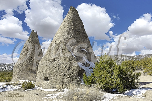
Tent Rocks Sentinels Wall Art Print
These rock formations in the Kasha-Katuwe Tent Rocks National Monument are what's left after millions of years of erosion. The caprocks on top of these hoodoos fell after the softer material underneath them was eroded away, leaving conical formations.